
Graphs
Often it is necessary not only to look at the value of a parameter at a particular point, but also to see how this value has changed over time. The chart in this case is the most convenient tool.
The set of available parameters depends on the model of your tracker. An exemplary list of parameters includes:
- Speed
- Altitude
- Battery
- HDOP / Accuracy
- GPS
- GSM network layer
- Temperature
- Inputs 1-5
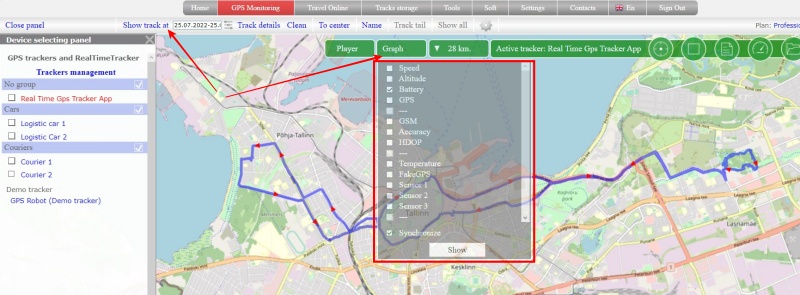
How to display graphs?
➔ Display the track for the desired date
➔ “Graphs” button will appear on the map, click on it
➔ From the list, check the checkboxes for the parameters by which the graph will be built
➔ Click the “Show” button
➔ A panel with constructed graphs will appear at the bottom of the screen
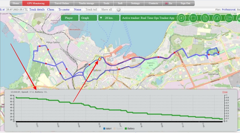
At the bottom of the panel there is a color indication of the chart parameters. If you want to exclude a parameter, click on its color indicator so that the parameter turns gray.
Drive on the chart and a point with the corresponding value will be shown on the track
The option is available on the tariffs: “Simple”, “Professional”